Living in Brisbane we like to escape on a North Stradbroke Island day trip a couple of times each year, it’s a great way to experience Morton Bay for both locals and visitors to Australia. We have a Straddie guide on the site already that shares the top things to do on the island but we’ve recently tried out a new way to get around that meant we were able to find a few new attractions. Today we want to share our new fave way to see North Stradbroke Island on a day trip.
Table of Contents
A bit about the island
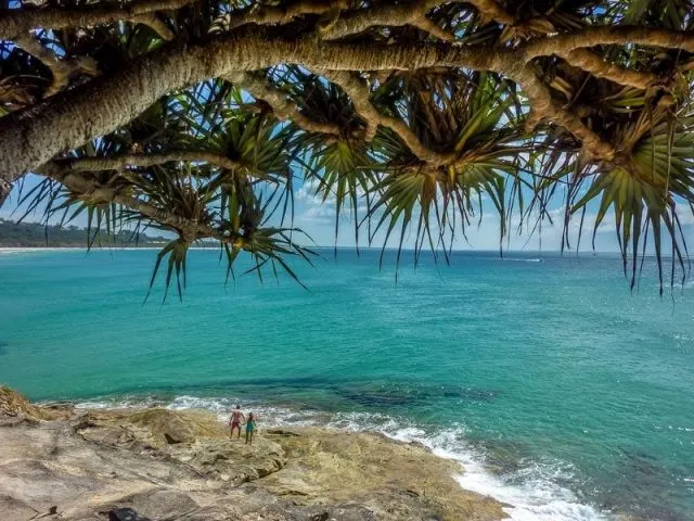
North Stradbroke Island, known affectionately as Straddie to the locals, is the second-largest sand island in the world. In fact, the 4 largest sand islands in the world can all be easily accessed from south-east Queensland and in order of size are Fraser Island, North Stradbroke Island, Morton Island and Bribie Island. If you’re interested in visiting some of the others I’ve linked up articles on those too.
The traditional name of the island is Minjerribah coming from a dialect of the local Quandamooka people. I’m told is means island in the sun which perfectly describes this sub-tropical paradise and while I’m sure it rains out here sometimes it has more than lived up to its name over the many years we’ve been visiting.
During the winter migration of whales from Antarctica to the tropical waters of the Great Barrier Reef for the breeding season, large numbers of them pass very close to the seaward side of the island offering excellent land-based views from Point Lookout. The Island is also a great place for sighting a variety of marine and land-based wildlife including dolphins, dugong, turtles, kangaroos and koala.
Roads connect a very small portion of the island from Dunwich to Amity Point and Point Lookout. The southern half of the island is accessed only by tracks or down the beach.
Getting to North Stradbroke Island
There are two ferry companies that run out to the island from Cleveland on a regular basis throughout the day and the timetables are similar. If you are taking your vehicle across then you will use Stradbroke Ferries, we take the Stradbroke Flyer which takes 25 minutes to make the crossing to One-Mile-Jetty.
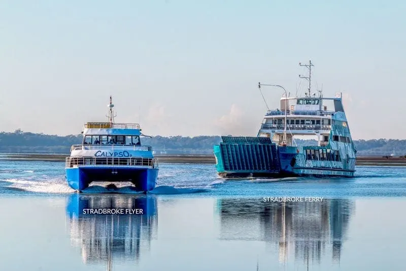
You can use public transport from Brisbane City by taking the train to Cleveland station and then the courtesy shuttle that departs for the jetty about 10-minutes prior to each sailing. It’s very easy to spot as you exit the small station, it’s a full-size bus with Stradbroke Flyer printed on the side.
At $20 for a return ticket on the ferry, it makes a good value day out. Once on the island, the local bus meets each sailing and it will take about 30 minutes to travel the 20 km to reach Point Lookout. We have done this many times and with the day pass it is a good option but for this trip, we have something new and fun planned.
If you are using the bus be aware that it’s not part of the Translink network and you will need to pay cash, the Go Card isn’t accepted on the bus or ferries.
Scooters on Straddie
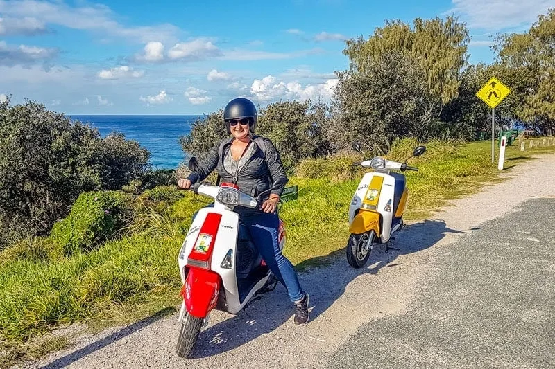
We spot Tony and the Scooters on Straddie minibus already waiting for us as we leave the ferry. Their base is only a few minutes away and we quickly go through the formalities of signing in and watching the short safety briefing. We pick out a helmet in our size and then it’s onto Bruce Almighty and Wally, our scooters for the day, for some instruction and a quick road check to make sure we are stable and confident then we are off.
It had been a very long time since I’d ridden a moped so we headed down to the Brown Lake first, it’s a quiet road and gave me a chance to get confident with the controls and max out the throttle, yep that’s around 45 km/hr so no cause for alarm, we’re on island time here so it’s perfect.
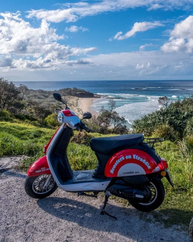
Pre-book your Scooters on Straddie experience and they’ll be waiting for you at the wharf.
North Stradbroke Island day trip itinerary
This island is beautiful and you could easily spend much longer here but in this article, we aim to give you options that can realistically be included into a day trip when you have your own transport or use a scooter to get around as we did.
If you are using the bus we’d recommend you head directly up to Point Lookout and spend your time within walking distance of there taking in the Gorge Walk, Deadmans beach and around the headlands to Cylinder Bay.
Where you have your own wheels we have a whole range of choices here and have included them on our custom map. While there is signage to most things on the island the position of markers on Google maps isn’t always helpful. Myora springs access, for example, had us stumped for a while.
Brown Lake (Bummiera)
Our first stop was out to Brown Lake as it’s only around 5 km from our starting point. It’s somewhere we’ve wanted to go on previous trips but the bus doesn’t go that way so you can only get there with your own transport or a tour. Heading out we followed the road inland towards the lakes then turned onto a dirt road for part of the trip, the small wheels on the scooters handled it surprisingly well as long as you dodged the occasional pothole.
The Brown Lake gets its name from its usual reddish-brown hue that is caused by tannin from Paperbark leaves sitting on the floor of the lake, in the right light, it looks like well-steeped tea. Today however the edge is crystal clear if a little chilly giving it a decidedly blue appearance from the sky reflecting in the water.

Brown Lake is a perched lake which means it is formed from a depression in the sand dune. The hole filled with water and leaf matter that settled forming a solid and impermeable lining that prevents the water from draining down to the water table below. They are actually pretty special and Queensland is home to over half of the worlds perched lakes.
There’s parking here, toilets and picnic tables under the trees. We spot a variety of birds in the branches overhead including a few less common varieties, several scarlet honeyeaters and a cuckoo.
Blue Lake (Karboora)
Continuing down the road further to the east you will come to the trailhead for the Blue Lake. This is another perched lake and usually appears deep blue in colour. It’s a 5.2 km return walk from the carpark on a sandy track through paperbark trees and wallum (banksia) which don’t offer much reprieve from the sun on a hot day.
Karboora means ‘deep silent pool’ in the dialect of the local Quandamooka People and because of the cultural significance of the lake they ask that you don’t swim in it.
You can continue on your scooter on this road out to Main beach. It’s a very long sandy open water stretch of beach, it’s beautiful and isolated but this access point is mainly used by 4-wheel-drives to access the beach and head south. The alternative is for them to drive north and come on near Point Lookout but this is much closer to the ferry.
Island Fruit Barn Cafe
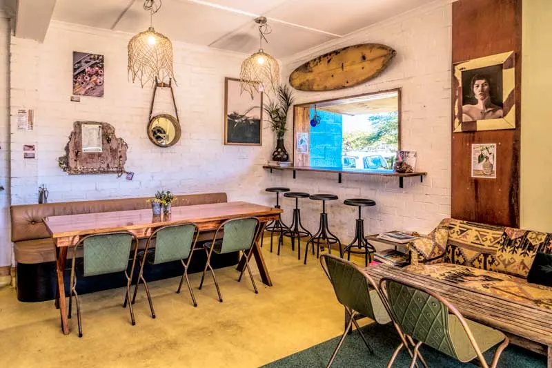
We were well ready for a morning cuppa before heading on up the island so we headed to this cute cafe on the main road as you head out of Dunwich. I’d have to say second breakfast or a sweet treat with your drink is going to be very tempting.
Fiona is lovely, the setting is quirky but comfortable and everything was delicious. Organic, vegan and gluten-free were all well catered for here. It’s a relaxed vibe so don’t expect your coffee-to-go on mainland time, allow time to chill.
Find them at 16 Bingle Road, Dunwich, QLD 4183
Myora (Capeembah) Springs
Myora Springs refers to quite a large area of mangroves not far out of Dunwich on the road north. The area has a history of use by the Quandamooka people going back 25,000 years and you may still see shell middens from times gone by on the banks of the spring.
In addition to its cultural significance, it’s also a nationally important wetland area and declared fish habitat.
There’s a short boardwalk through here with some informative signs and access down into the water. It’s low tide in this photo but if you want to swim I’d suggest timing your visit closer to high tide.
Amity Point
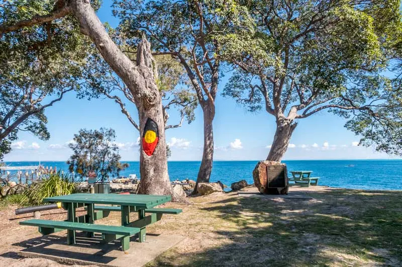
Amity Point is a favourite with the boaties and fishermen. It’s a quiet and relaxed part of the island with a camping ground here to the left just beyond the boat ramp.
You can see spectacular sunsets here across the bay and will regularly see dolphins off the beach. The trees behind the campground are also home to koalas.
There’s a netted area just off the camping ground for swimming. An underwater shelf falls away very close to shore here to a depth of around 30 meters which is what makes it so attractive for fishing but bull sharks which can be unpredictable are frequently seen here. Shark attacks are rare in Australia despite our love of the water but caution is suggested.
The Blue Room Cafe
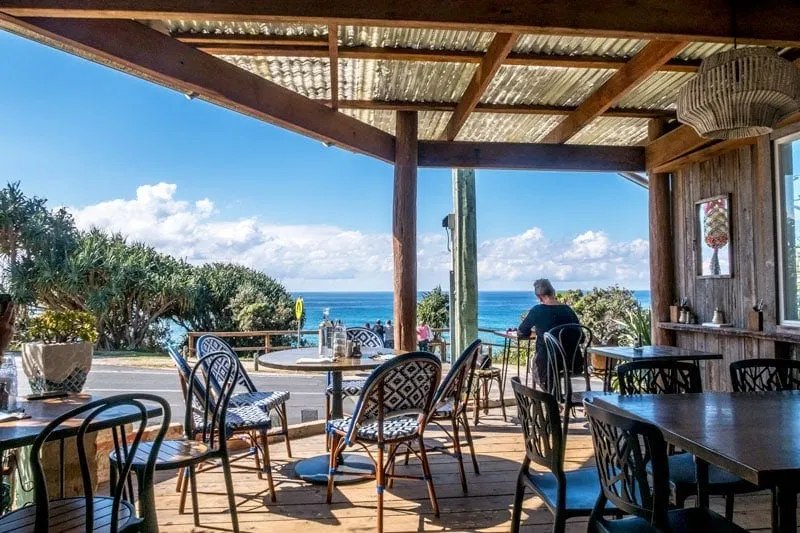
Next stop for lunch was the Blue Room Cafe on Point Lookout. This view is stunning out over Frenchmans Bay and as we sat here there was a fairly consistent display of whales breaching and spouting offshore as we ate.
I went with the baked pancakes with bacon and maple syrup alongside a berry smoothie. Drew had the iced coffee with a burger on Turkish bread. Both very happy with our choice and will definitely return. It’s popular though, the photo above is a bit deceptive as within minutes of sitting down all the tables were full again, we just hit a lull in the crowd.
The menu is fairly short but the food is great quality, mostly organic, flavourful and with realistic serving sizes.
Make sure you stick your head into the health food grocer next door too if you are looking for anything else for your stay or some fresh fruit snacks for later. Some interesting items and fresh produce.
Found at 27 Mooloomba Rd, Point Lookout QLD 4183
The Gorge Walk
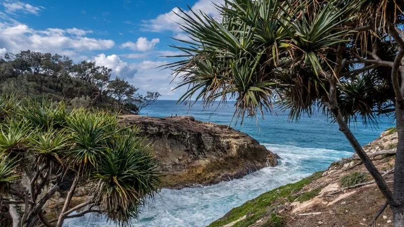
The gorge walk is the most popular area on North Stradbroke and when we are using the bus we head up here directly from the ferry. The boardwalk makes for easy walking although it’s not suitable for wheelchairs as there are steps in some of the steeper parts.
It’s fabulous on all tides and we’ve never been through here without ticking whales, dolphins and turtles off our list and most times we’ll also run into a mob of kangaroos somewhere along the way. Sometimes they come hopping past at speed, other times they are quietly resting on the hillside.
There’s also a good diversity of bush and sea birds with Osprey and Brahminy kites often seen on the thermals close to the cliffs. The gorge itself if a great spot to see turtles during the slack and outgoing tide when the wave action is reduced.
There are also a couple of parts where you can detour down onto the rocky outcrops and take it all in, one of them has a blowhole where the tide roars in especially on the high tide.
Main Beach
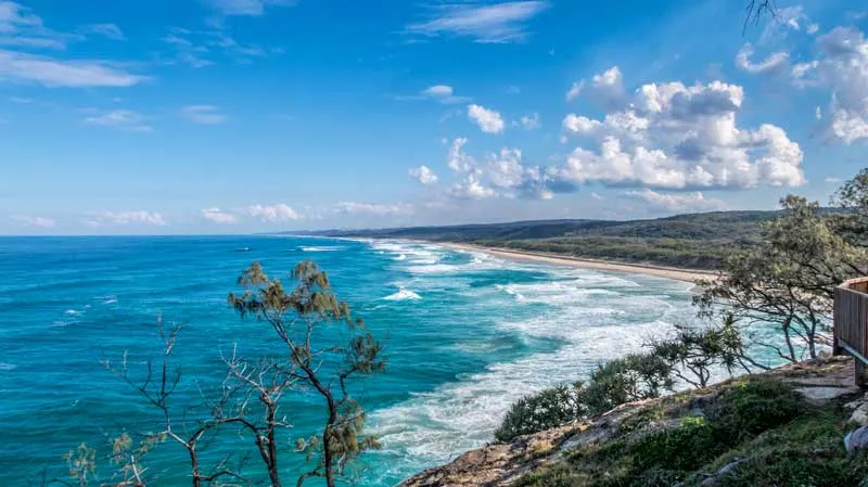
We mentioned earlier that you can access Main Beach by crossing the island directly from Dunwich but you can also get to it from below Point Lookout. This northern end of the beach is popular for day visitors and in the right conditions with surfers. With a 4-wheel-drive you are able to drive on the beach and access areas, and solitude, that you can’t by road.
Frenchmans Bay
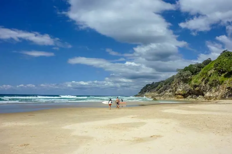
You can look down into Frenchmans Bay from Point Lookout and the start of the Gorge walking trail. During the late 1800s, 4 men landed on the beach having sailed down from French Polynesia. It gives you an idea of just how special this place is when you hear their descendants still live on the island.
The 500 m long sandy beach faces east meaning it’s hit by some strong dominant winds and has serious rips, be very careful if you surf or swim at this one.
Deadmans Bay
Continue walking along the beach and you’ll come to Deadmans Bay. The naming of this beach is as macabre as it sounds.
In 1902 the Prosperity, a ship carrying machinery, ran aground and sank on it’s way to Brisbane just off the coast of Point lookout. Two lives were lost that day but only one body recovered. Fifty-four years later a skeleton and a boot were uncovered in the sand on this beach, they are believed to belong to the missing seaman.
Cylinder Beach
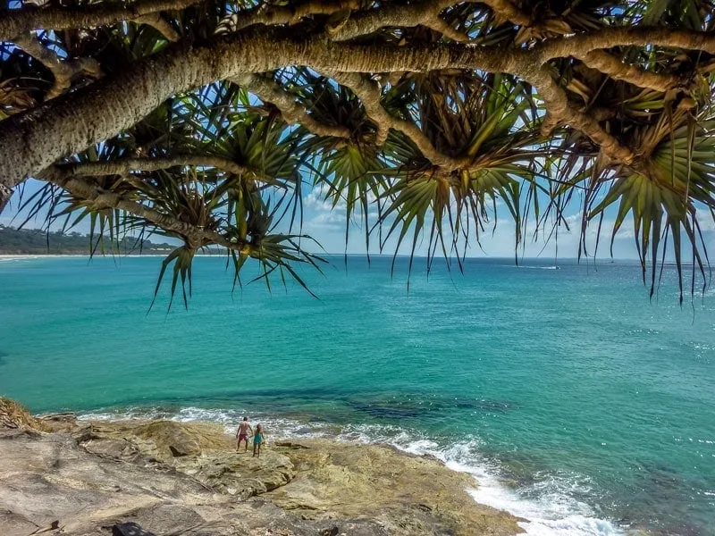
Facing due north Cylinder beach is sheltered for the predominant winds. It’s a long and stunning beach with an extremely popular camping ground. The Straddie pub behind has a bistro and beer garden with spectacular views out over the water and if you are using the bus to get back down to the ferry there is a stop just out from here on the main road.
It takes its name from being the 1932 landing point of the giant acetylene gas cylinders that were brought in during the construction of the lighthouse up above Point Lookout.
Wrapping up our Straddie day trip
With the afternoon getting on we hopped back on our scooters for the ride back to Dunwich. You’ll want to allow around half an hour from Point Lookout. The roads are good and through most of it, you’ll have bushland on either side of the road. Most of the way has a good hard shoulder to pull out of the way of traffic coming from behind at the speed limit which ranges from 60-80 km/hr. There were a couple of times we pulled over to give trucks more room to pass but traffic was light.
Once in Dunwich was filled up the scooters at the petrol station in town and dropped them back at Scooters on Straddie depot before being dropped back down at the wharf for the ferry home.
We both loved this new way of exploring Straddie, we found some new spots and got to see some of this beautiful island away from the holiday crowd.
Interested? Save these to Pinterest
